Precision Innovation for Every Acre
Exsol Innovindo delivers world-class geospatial solutions. From high-speed 3D laser scanning to robotic total stations, we empower your vision with absolute accuracy.
Precision Guaranteed
Equipped with the latest Topcon & Faro technology for millimeter-accurate data.
Expert Support
Comprehensive technical guidance and after-sales service for all surveying systems.
Field Ready
Rugged, IP-rated hardware designed to withstand the harshest construction environments.
Excellent Solutions for Land & Construction
Exsol provides high-precision solutions for land survey, construction, and building applications.
We specialize in automated monitoring systems, satellite-based GNSS, and labor-saving computerized surveying systems
that redefine efficiency in the field.
About Us
Exsol is making major effort to provides Excellent Solution high-precision for land survey, construction, building applications, automated monitoring system on existing structures, satellite-based Global Navigation Satellite System for surveying, develop labor-saving, computerized land surveying systems, laser equipped tools, and machine control systems.
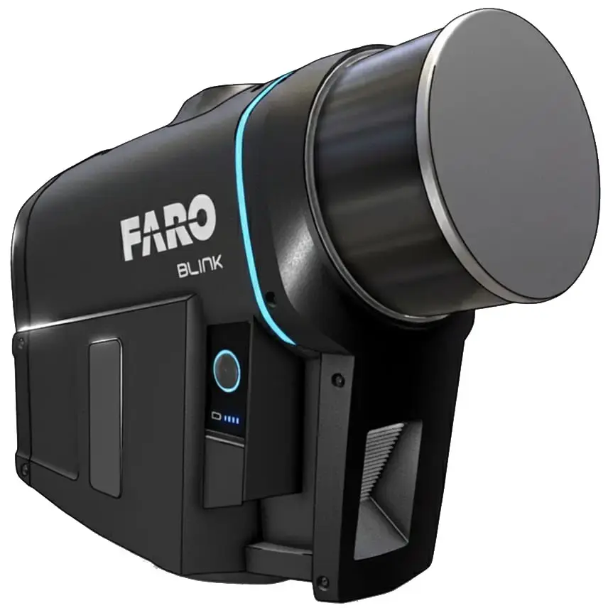
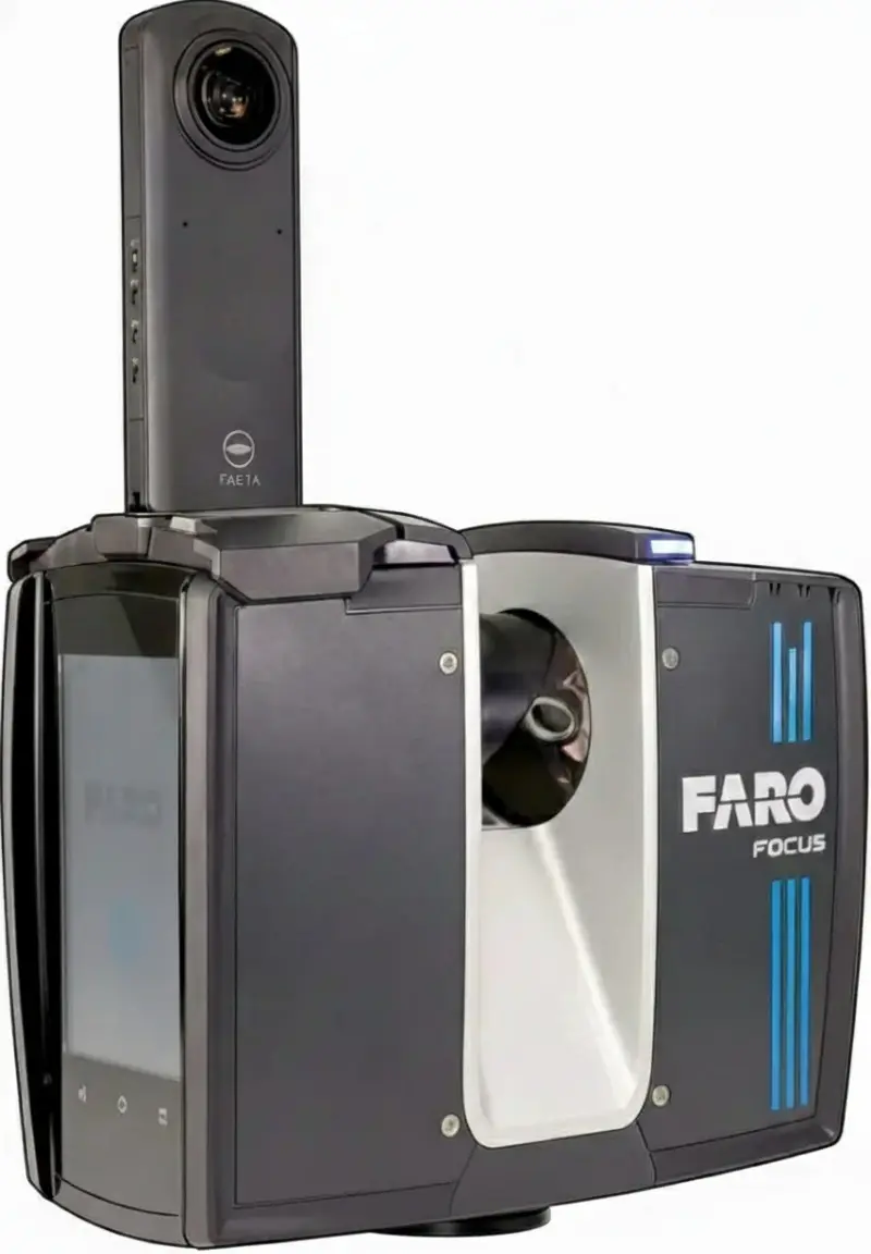
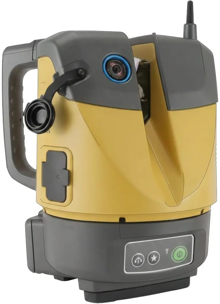
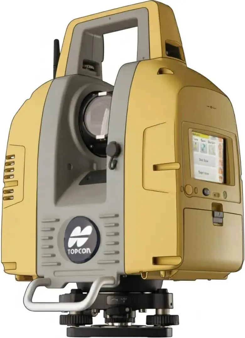
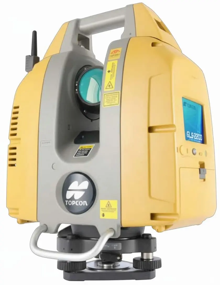
3D Laser Scanner
Capture complex environments in minutes with high-speed 3D imaging and millimeter-level accuracy for BIM and facility management.
🎯 Acc: ±4mm | 📷 Camera: 125 MP (Raw)
🔋 Battery: 3h | 📦 3.7kg | ↕️ Height: 225mm | 🛡️ IP54
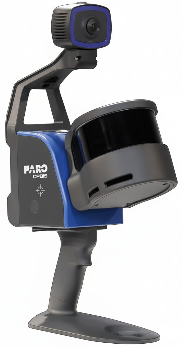
🎯 Acc: ±2mm (Flash) | 📷 Camera: 8 MP
🔋 Battery: 3h | 📦 Handheld: 2.1kg | 🛡️ IP Rating: —
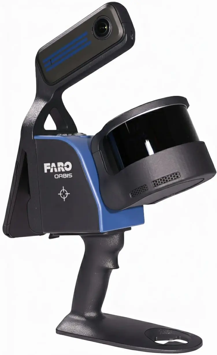
Premium
🎯 Acc: High SLAM | 📷 Camera: 72 MP
🔋 Battery: 3h | 📦 3.6kg | ↕️ Height: 337mm | 🛡️ IP54
Max
🎯 Acc: ±1mm | 📷 Camera: 266 MP
🔋 Battery: 4h | 📦 4.4kg | ↕️ Height: 230mm | 🛡️ IP54
🎯 Acc: ±3mm | 📷 Camera: 5 MP
🔋 Battery: 2.5h | 📦 4.9kg | ↕️ Height: 280.1mm | 🛡️ IP55
GLS-2000M
GLS-2000L
🎯 Acc: ±3.5mm | 📷 Camera: Dual 5 MP
🔋 Battery: 2.5h | 📦 11.0kg | ↕️ Height: 412mm | 🛡️ IP54
GLS-2200M
GLS-2200L
🎯 Acc: ±1mm | 📷 Camera: Dual 5 MP (HDR)
🔋 Battery: 2.5h | 📦 10.0kg | ↕️ Height: 390mm | 🛡️ IP54
🎯 Acc: ±1.5mm | 📷 Camera: 5 MP
🔋 Battery: 1.3h | 📦 7.2kg | ↕️ Height: 430mm | 🛡️ IP54
🎯 Acc: ±1mm | 📷 Camera: Dual 5 MP
🔋 Battery: 1.3h | 📦 7.3kg | ↕️ Height: 430mm | 🛡️ IP54
Digital Theodolite
Our digital theodolites offer unbeatable battery life and clear laser guidance for simplified angle measurements and general construction layout.
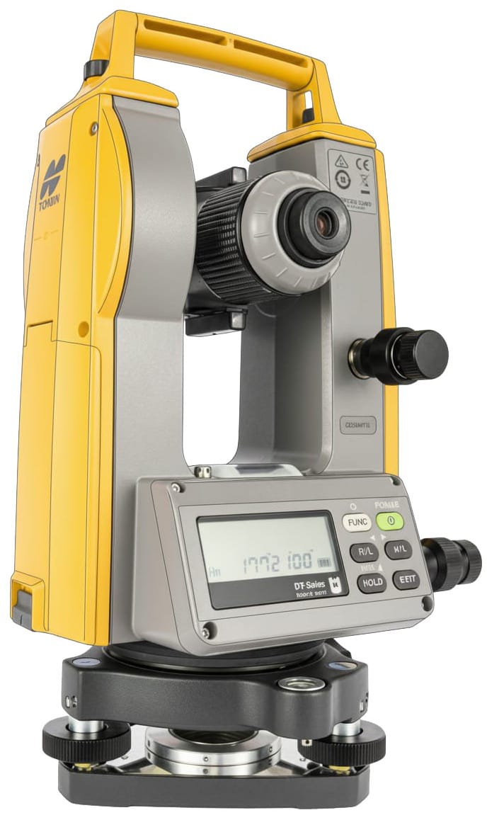
DT-307K
DT-309K
🔭 Magnification: 30x
📏 Tilt Sensor: Yes (5″ model)
🔋 Battery: 140h to 170h
🛡️ Rating: IP66 Dust/Waterproof
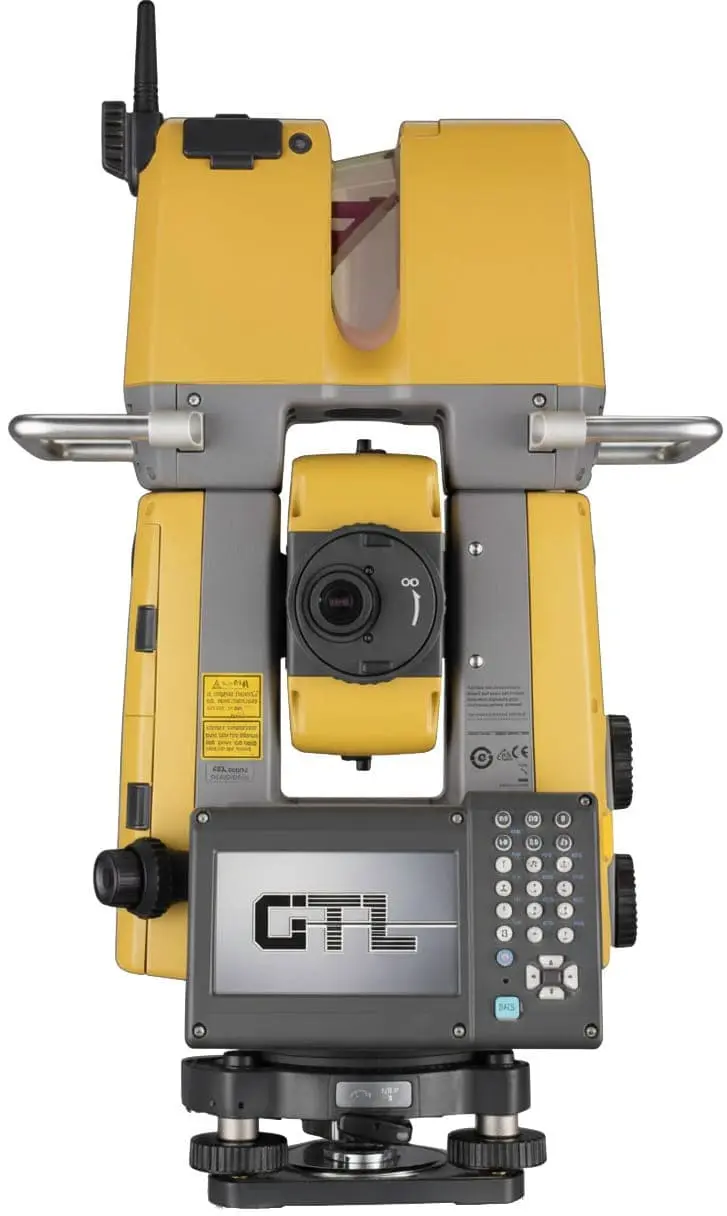
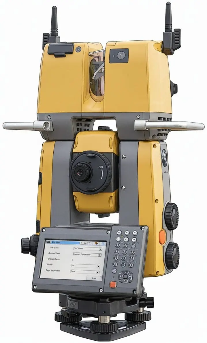
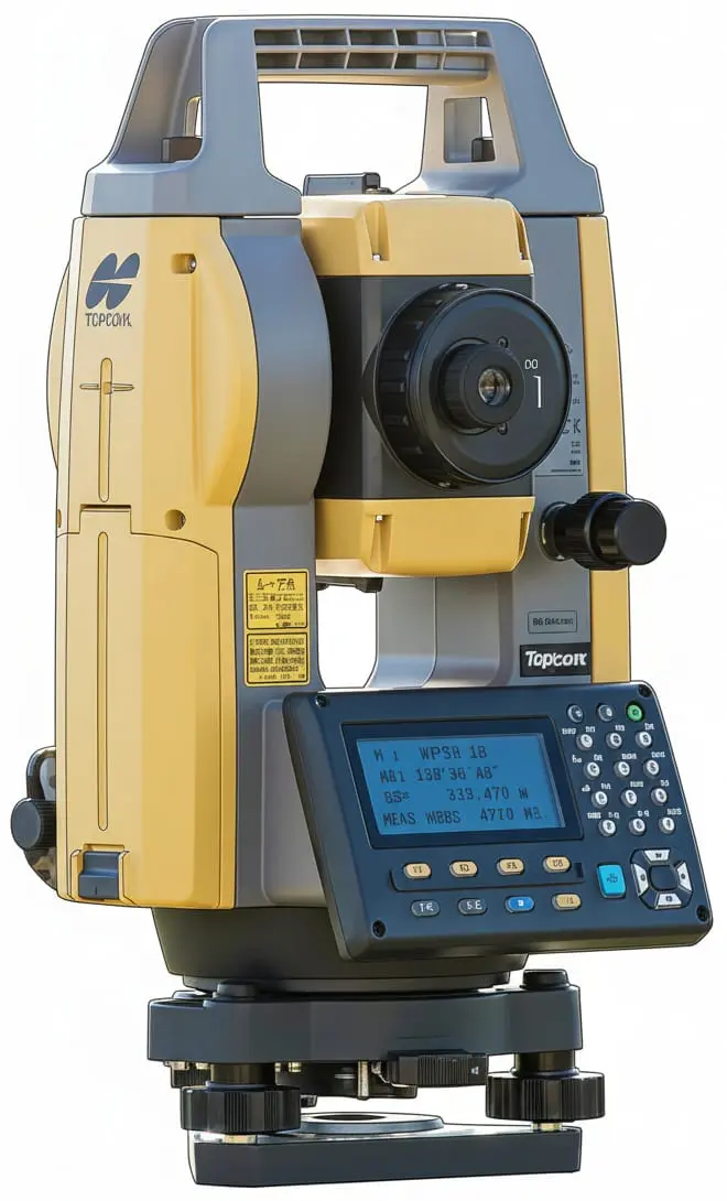
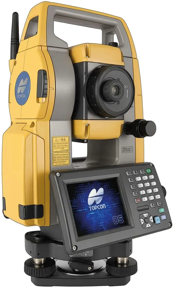
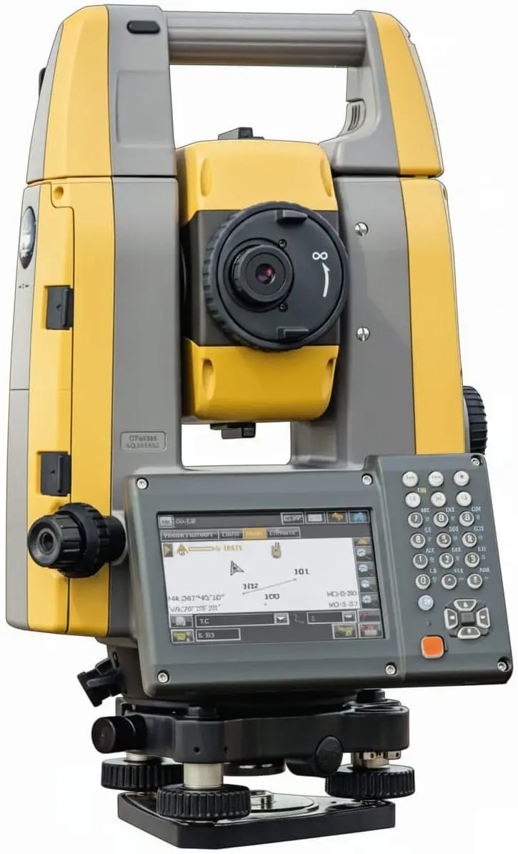
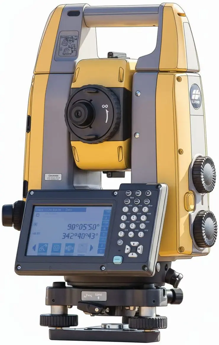
Total Station
From manual to fully robotic systems, our Total Stations provide the speed, tracking power, and long-range reflectors needed for professional surveying.
📏 Reflectorless: 500m | 💎 Prism: 4,000m
🎯 1.5mm + 2ppm X D | 📦 5.1kg | ↕️ 348mm height
🔋 14h | 🛡️ IP66

GM-103 GM-105
📏 Reflectorless: 1,000m | 💎 Prism: 6,000m
🎯 1.5mm + 2ppm X D | 📦 5.3kg | ↕️ 348mm height
🔋 28h | 🛡️ IP66
OS-203 OS-205
📏 Reflectorless: 1,000m | 💎 Prism: 6,000m
🎯 1.5mm + 2ppm X D | 📦 5.7kg | ↕️ 348mm height
🔋 20h | 🛡️ IP65
📏 Reflectorless: 1,000m | 💎 Prism: 5,000m
🎯 1mm + 2ppm X D | 📦 5.8kg | ↕️ 338mm height
🔋 4h | 🛡️ IP65
📏 Reflectorless: 800m | 💎 Prism: 4,500m
🎯 2mm + 2ppm X D | 📦 5.8kg | ↕️ 338mm height
🔋 4h | 🛡️ IP65
📏 Reflectorless: 1,000m | 💎 Prism: 5,000m
🎯 1mm + 2ppm X D | 📦 5.8kg | ↕️ 338mm height
🔋 4h | 🛡️ IP65
📏 Reflectorless: 800m | 💎 Prism: 4,500m
🎯 2mm + 2ppm X D | 📦 5.8kg | ↕️ 338mm height
🔋 4h | 🛡️ IP65
💎 Working Range: 130m | 🔦 Laser Plummet
🎯 3mm + 2ppm X D | 📦 4.1kg | ↕️ 291mm height
🔋 6h | 🛡️ IP65
💎 Working Range: 60m
🎯 3mm + 2ppm X D | 📦 4.0kg | ↕️ 291mm height
🔋 6h | 🛡️ IP65
💎 Prism: 130m
🎯 3.0mm + 2ppm X D | 📦 4.0kg | ↕️ 291mm height
🔋 5h | 🛡️ IP65
📏 Reflectorless: 1,000m | 💎 Prism: 6,000m
🎯 1.5mm + 2ppm X D | 📦 7.2kg | ↕️ 365mm height
🔋 2h | 🛡 IP54
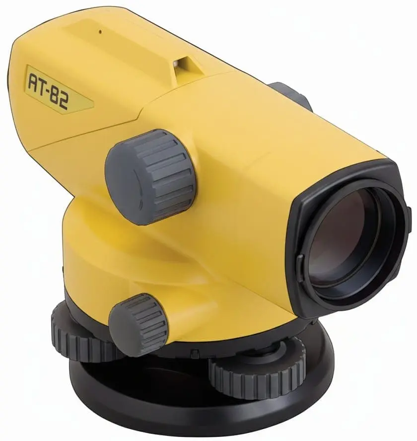
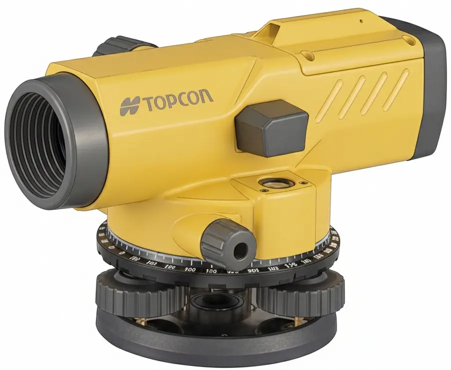
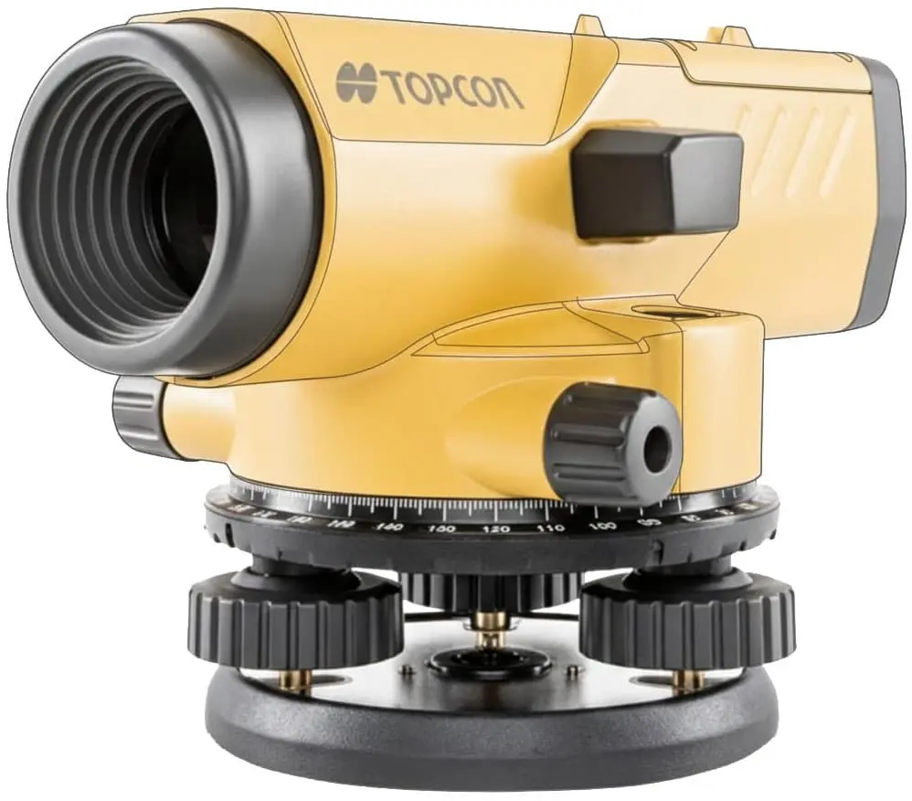
Auto Level
Reliable optical leveling instruments designed for fast setups and stable performance in diverse field conditions.
🔭 Magnification: 32x
📏 Min. Focus: 0.2m / 0.3m
🛡️ Rating: IPX6 Waterproof
⚙️ Compensator: Magnetic Dampening
🔭 Magnification: 28x
📏 Min. Focus: 0.2m / 0.3m
🛡️ Rating: IPX6 Waterproof
⚙️ Compensator: Magnetic Dampening
🔭 Magnification: 24x
📏 Min. Focus: 0.2m / 0.3m
🛡️ Rating: IPX6 Waterproof
⚙️ Compensator: Magnetic Dampening
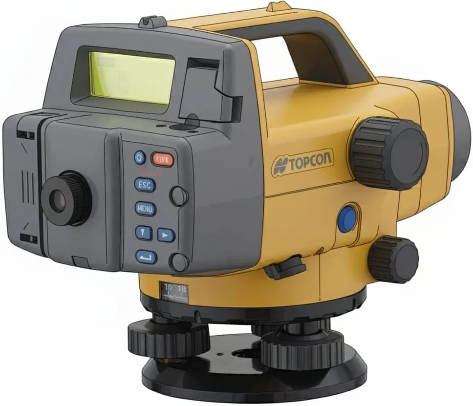
Digital Level
Eliminate manual reading errors and increase speed with our digital levels, featuring advanced wave-and-read technology.
DL-503
🔭 Zoom: 32x (502) / 28x (503)
💾 Memory: 2,000 internal points
🔋 Battery: 8.5h (BDC46C)
🛡️ Rating: IPX4 Waterproof
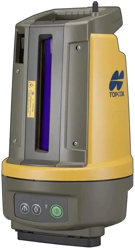
Rotating Laser
Tough, precise, and long-range lasers built for everyday site leveling and multi-slope grading tasks.
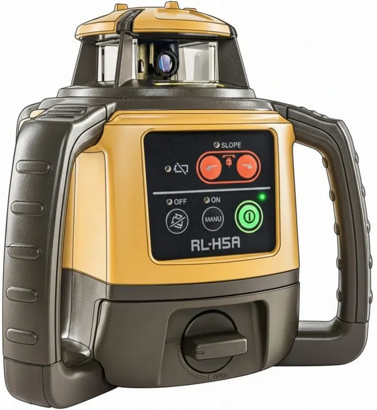
📏 Working Range: 800m (Diameter)
🔋 Battery: 100h (Alkaline) / 60h (Ni-MH)
🛡️ Rating: IP66 | ⚙️ Manual Slope: Yes
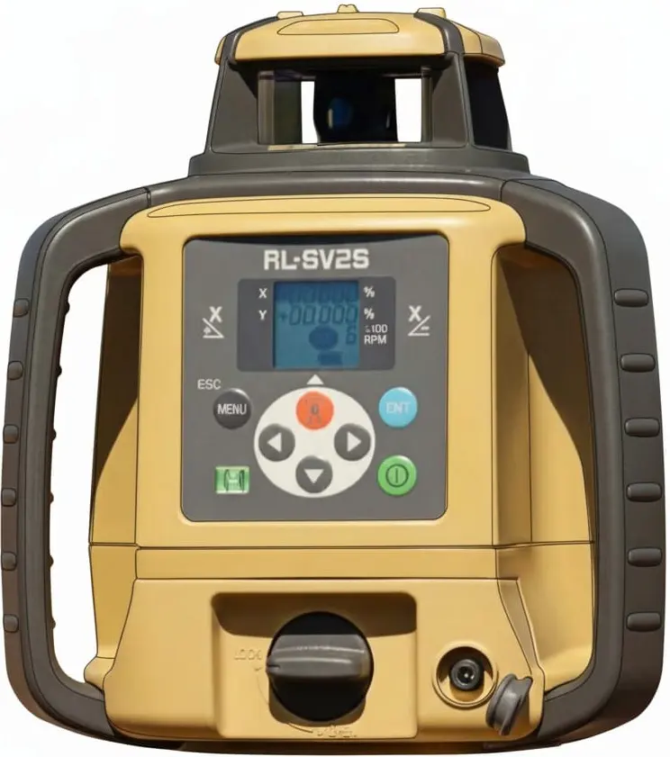
📏 Working Range: 800m | 📉 Grade: Dual ±15%
🔋 Battery: 120h (Alkaline) / 65h (Ni-MH)
🔄 Layout: Horizontal, Vertical, & Dual Slope
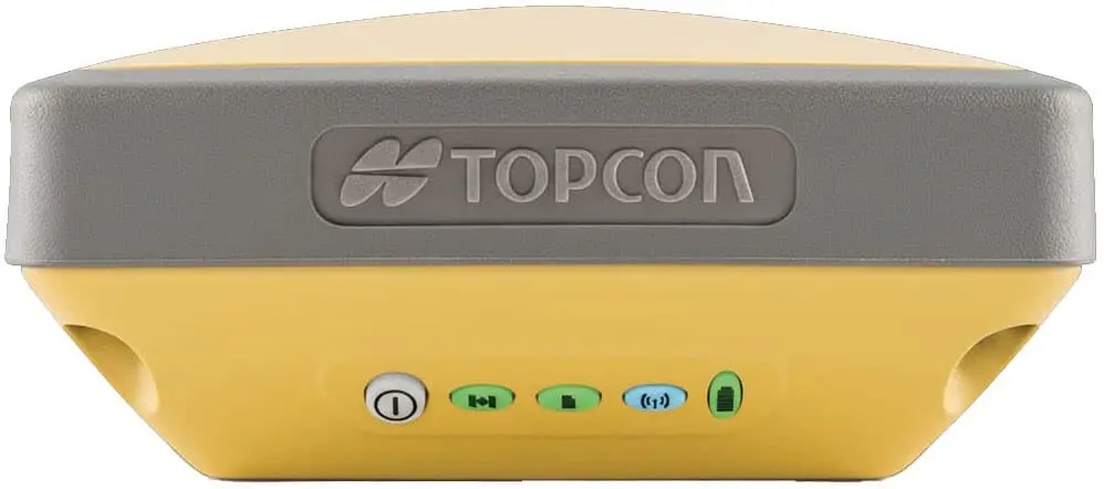
GNSS Receiver
Experience satellite-based positioning with rugged receivers designed for high-performance tracking and long battery life.
🔄 Tilt: No | 📶 Communication: LongLink Bluetooth
📦 0.85kg | 🔋 20h | 🛡️ IP67
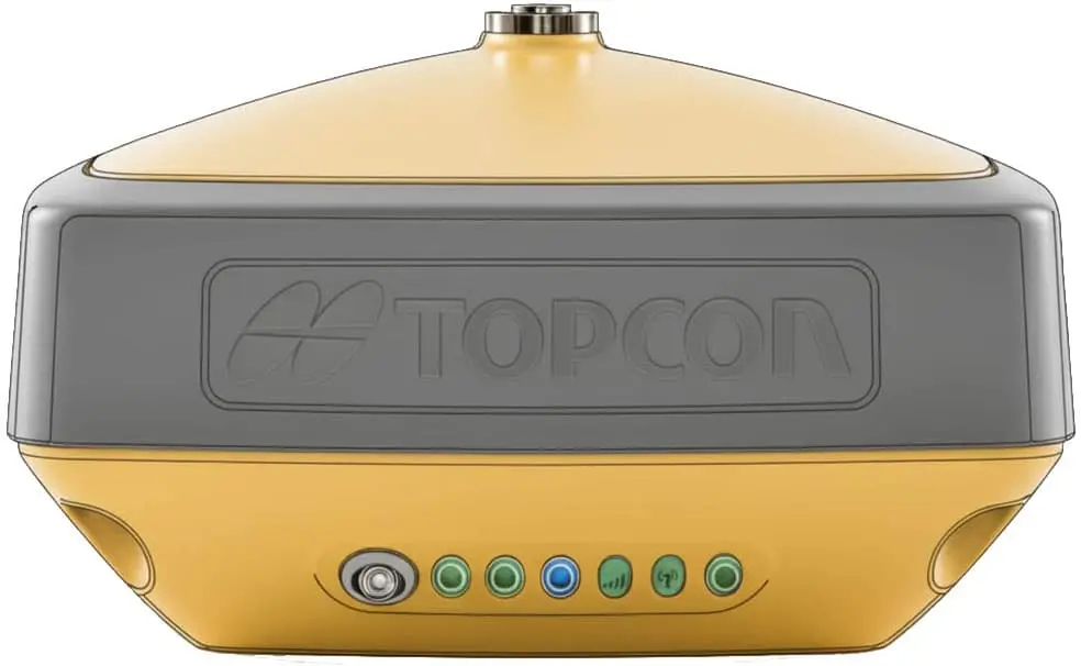
🔄 Tilt: Up to 15° (TILT™) | 📶 Communication: UHF/VHF
📦 0.85kg | 🔋 Up to 20h | 🛡️ IP67
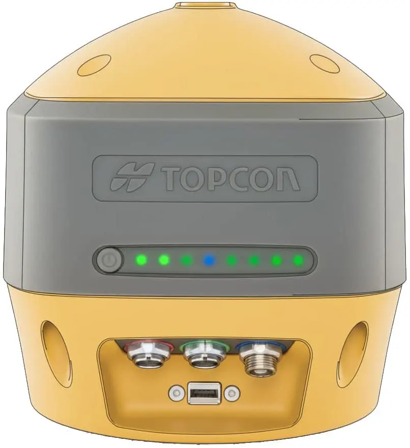
🔄 Tilt: Up to 15° (9-axis IMU) | 📶 Communication: Multi-Network
📦 1.17kg | 🔋🔋 9h (hot swap) | 🛡️ IP67
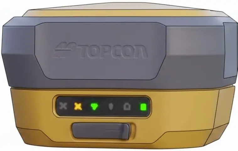
🔄 Tilt: Up to 60° (Advanced IMU) | 📶 Communication: 4G/LTE + UHF
📦 0.99kg | 🔋 10h | 🛡️ IP67
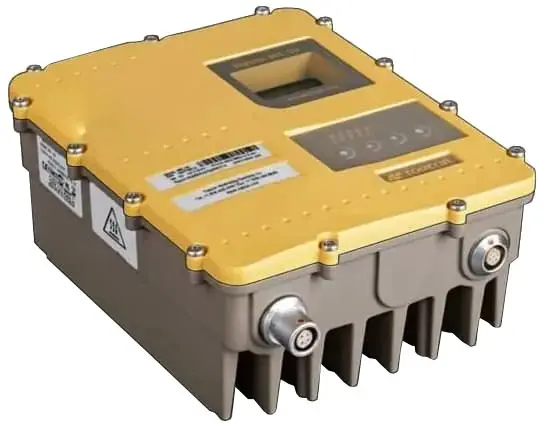
GNSS Enhancer
Professional-grade reference stations and high-power radios designed to extend range and ensure maximum signal stability.
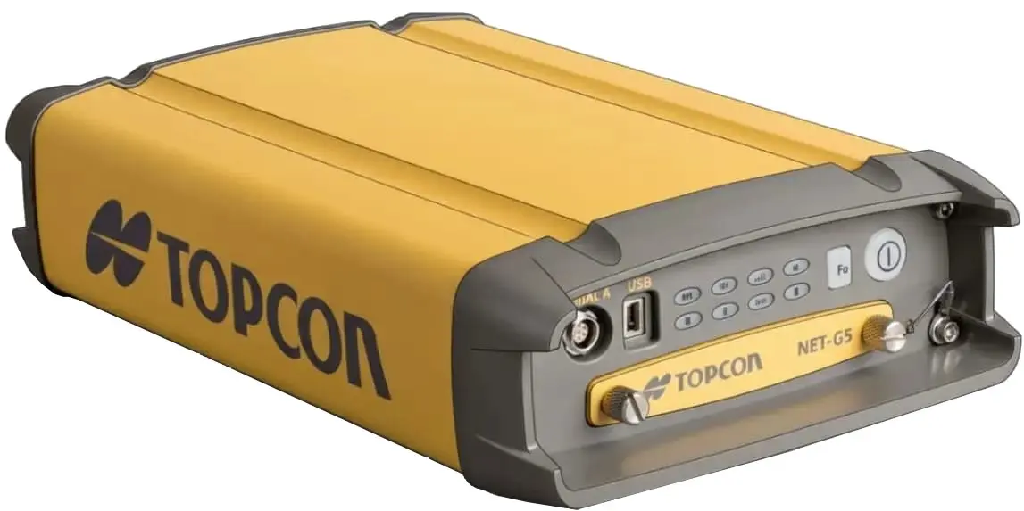
🌐 Constellations: All GNSS (Full Spectrum)
💾 Memory: 32GB SDHC Support
🛡️ Rating: IP67 Waterproof
📶 Conn: Bluetooth, Wi-Fi, Ethernet
📏 Range: Up to 80 km (Line of Sight)
📻 Frequency: 403 – 473 MHz
🛡️ Rating: IP67 Weatherproof
🖥️ Interface: Weather-protected LCD
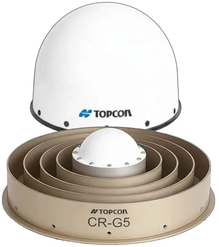
📡 Signal: Full Wave Tracking
🌀 Tech: Choke Ring Multipath Rejection
🛡️ Rating: IP67 & 1m Drop Tested
📏 Size: 380mm Diameter
Field Controller
Tough, sunlight-readable tablets and controllers designed to manage complex 3D data and project workflows directly from the field.
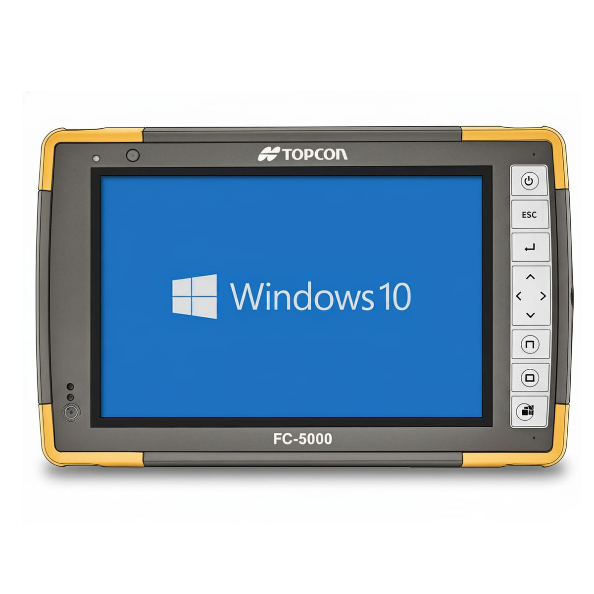
⚡ Speed: 1.33 GHz (Up to 1.86 GHz)
🖥️ Screen: 7″ Sunlight Readable
💾 Memory: 8GB RAM | 64GB SSD
🔋 Battery: 10 Hours (Single)
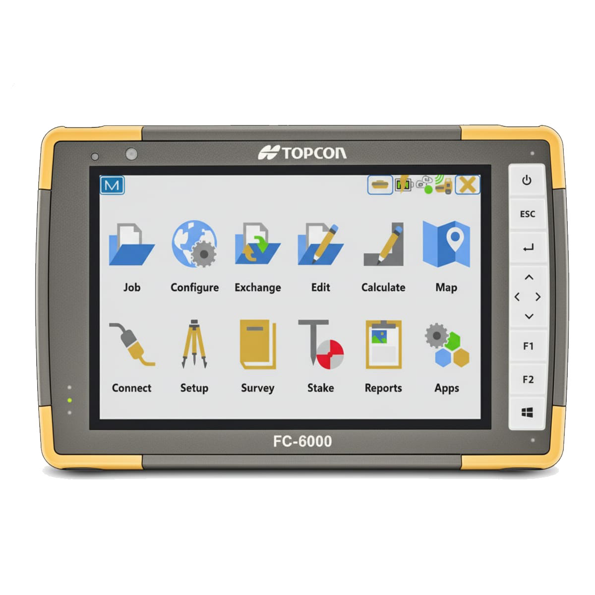
⚡ Speed: 1.10 GHz (Up to 2.50 GHz)
🖥️ Screen: 7″ High-Definition
💾 Memory: 8GB RAM | 128GB SSD
🔋🔋 Battery: 15+ Hours (Hot-Swap)